
NCPedia's Early Settlement article provides valuable context for understanding North Carolina's colonial growth. The colorful map below illustrates the frontier development from 1657-1835. The article explores the finer points that spurred that development, including the massive and rapid growth that occured after King George took NC lands back from the Lords Proprietors in 1729. Discover why this created a boom that lasted until the Revolution era.
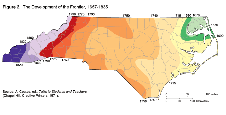
The article shares two other maps that provide background for understanding early settlement and migration trends.
A trail map traces not only the Great Wagon Road, but also migration routes from coastal ports. It highlights which groups tended to take each path. The associated text emphasizes how the Piedmont and coastal areas were essentially cut off from each other. By the mid 1700s, the Piedmont settlers had more trade and communication with Philadelphia and their South Carolina neighbors than the coastal NC colonists and government centers.
Another map documents settlements and the population diversity in 1730, organized by settlers' national origins.
Visit the Early Settlement page at NCPedia to explore these resources for your ancestor research, and consider bookmarking it for future reference.
Comments
Post a Comment